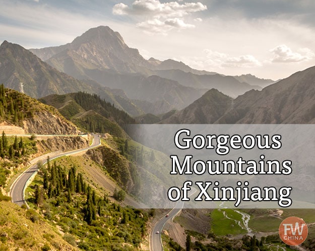
Stunning China Mountains (only found in Xinjiang)
China is known for some unique landscapes, but none are quite as breathtaking as the various China mountains. What most people don’t know, though, is that some of the most scenic mountains in China are found in the remote western region known as “Xinjiang”.
If you were ever under the impression that people only travel to Xinjiang, China’s remote western region, to ride a camel in the desert…
…think again.
Over the past decade, I’ve had a chance to explore the mountains all around here both by traditional means as well as by cycling around Xinjiang. I’ve come away with some fantastic memories and beautiful photos.
While I’ve spent time hiking around many of the breathtaking lakes around Xinjiang, each of which are off the beaten path, I’m going to turn our attention today to the grand China mountains.
This next set of natural wonders might be a little more difficult to hike in a day.
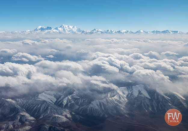
K2 in Xinjiang 乔戈里峰
K2 is not only the highest point in the Karakoram mountain range, it’s also the highest point in both Pakistan and Xinjiang, where the two regions share a border.
You’d never know it from this picture, but K2 – the peak in the distant left – comes in second place for both the “world’s highest” category (after Mt. Everest) and the “world’s deadliest” (which is held by Annapurna).
Climbers pay vast sums of money to summit this deadly peak, and historically have been able do so both from the Pakistani side and the China side.
Currently, due to geo-political sensitivites, it’s much harder to start the expedition from inside Xinjiang.
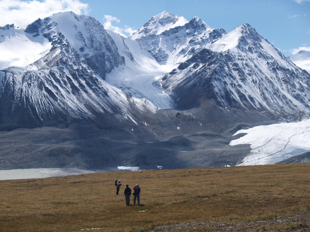
TianShan China Mountains 天山
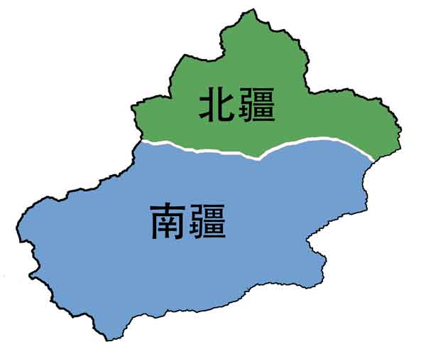
The Tianshan, or “Heavenly Mountains” are a range that slice through the middle of the Xinjiang region, divicing it into the northern half (北疆 or “Bei zhang”) and southern half (南疆 or “Nan zhang”).
Any flight into or out of the capital of Urumqi will put the stunning peaks of the Tianshan on display outside your airplane window. It’s pretty much impossible to miss as the city is situated in a valley of the range.
One of the most famous peaks within this range of China mountains is Bogda, a peak that towers over the popular Heavenly Lake.
It’s possible to do quite a bit of hiking around this range, and there are also a few places that make for great places to ski or snowboard in Xinjiang.

Muztagh Ata 慕士塔格峰 (Kunlun)
The Kunlun mountains, which run together with the Pamir mountains on the western border of Xinjiang, offer some of the most stunning scenes anywhere in China.
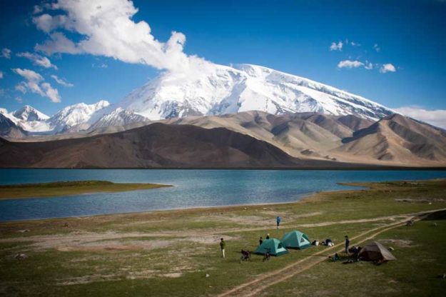
Muztagh Ata towers above the equally famous Karakul Lake, a beautiful one-night detour along the Karakoram Highway.
Technically, this isn’t a terribly high mountain, which makes it popular among climbers, but it also has a reputation for high fatality rates.

Flaming Mountains 火焰山 (Turpan)
The Flaming Mountains of Xinjiang are an oddly-shaped geological feature rising out of the Turpan Basin, the 2nd lowest point in all the world.
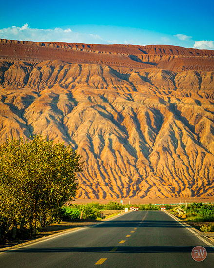
During certain seasons and specific times of the day (namely dawn and dusk) the rocks glow a brilliant red and orange, hence the name “flaming” mountains.
Hiking the mountains is possible (there’s even a desert race that has happened here) but care is required as the heat here can reach record levels. I’m talking world record heat of 120F+!
These China mountains were made famous in the fanciful novel based on the journey of Chinese monk Xuan Zang. His trip through the desert oasis of Turpan is legendary.
Altai Mountains 阿尔泰山脉
On the northern end of Xinjiang, where China shares a small border with Russia, another mountain range fills the map: the Altai Mountains (also spelled “Altay Mountains”).
This set of towering rocks create a border divide between China, Russian, Mongolia, and Kazakhstan. The name literally means “mountains of gold” and the area is well-known for the minerals – including gold – that it provides.
Of course, this area also boasts Kanas Lake, home to the famous Kanas Lake Monster (which I’ve listed among other interesting facts about Xinjiang here).

Beautiful China Mountains in Xinjiang
From the Tianshan to the Kunlun; from the Altai to the Pamir. The China mountains in Xinjiang represent some of the most beautiful in all the world.
They may not be the easiest to climb nor are they particularly conducive to hiking, but they offer amazing views from airplane windows and unbelievable experiences on the roads that snake between them.
When you travel to Xinjiang, you’ll certainly find that the region is covered in huge deserts like the Gobi and the Taklamakan…
…but you’ll also get to see that these deserts are guarded by some spectacular mountain ranges.